Floods and Damages

Discussions on Kruger of a General Nature
User avatar
Flutterby
Posts: 44029
Joined: Sat May 19, 2012 12:28 pm
Country: South Africa
Location: Gauteng, South Africa
Contact:

Re: Pictures of the 2012 Floods

Post by Flutterby »

Skukuza Deck

Image

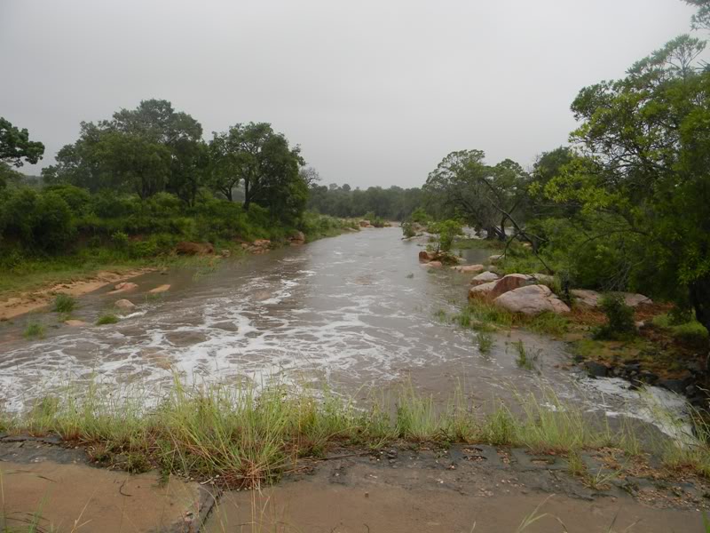
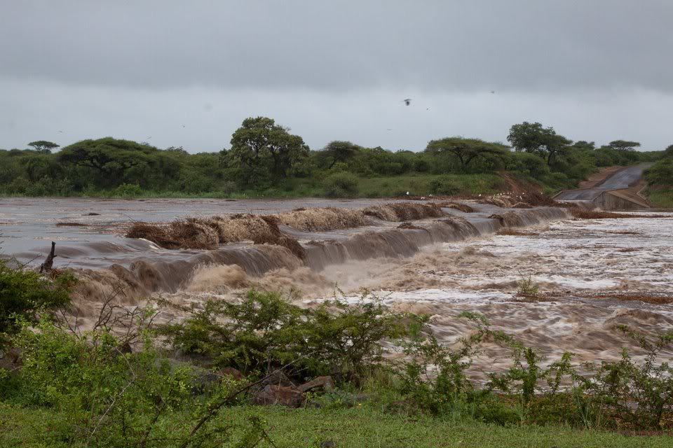
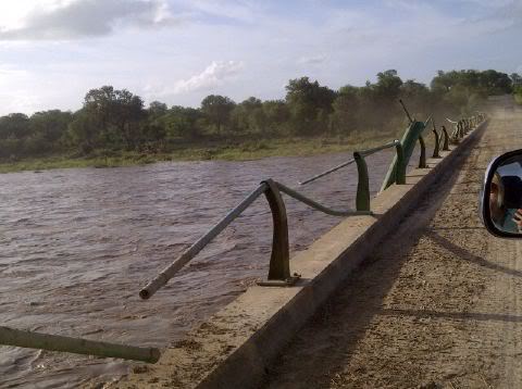
Lower Sabie, low-level bridge

Image

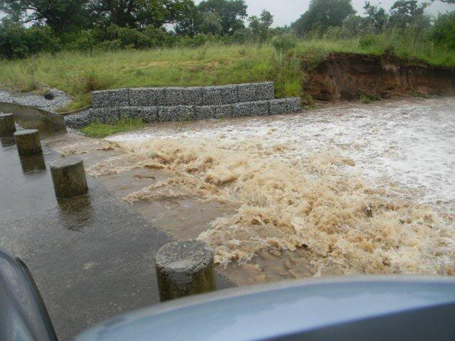
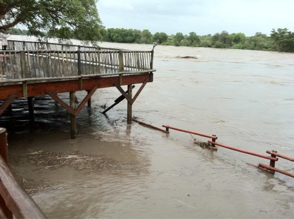
High level bridge near Skukuza

Image

Image

Image

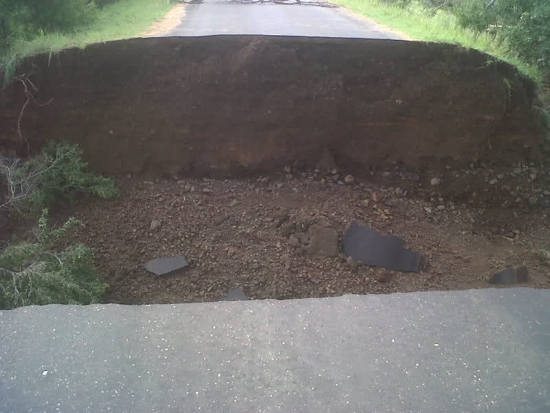
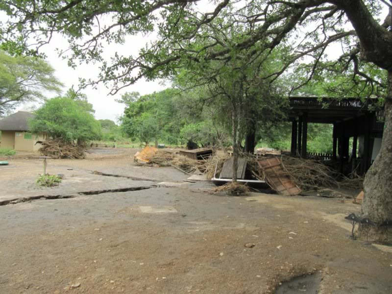
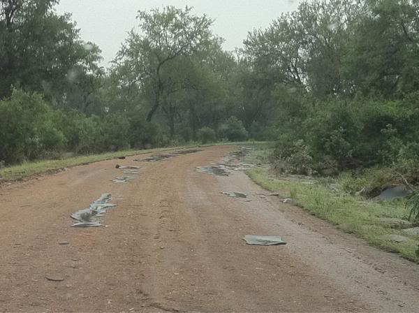
H4-1 – Tar pulled off the road

Image


User avatar
Flutterby
Posts: 44029
Joined: Sat May 19, 2012 12:28 pm
Country: South Africa
Location: Gauteng, South Africa
Contact:

Re: Pictures of the 2012 Floods

Post by Flutterby »

Taken near Letaba (Pic posted by Shutterbug)

Image

Letaba

Image


User avatar
Flutterby
Posts: 44029
Joined: Sat May 19, 2012 12:28 pm
Country: South Africa
Location: Gauteng, South Africa
Contact:

Re: Pictures of the 2012 Floods

Post by Flutterby »

Sable Dam (Courtesy of Krugerpark.com on Facebook)

Image


User avatar
Flutterby
Posts: 44029
Joined: Sat May 19, 2012 12:28 pm
Country: South Africa
Location: Gauteng, South Africa
Contact:

Re: Pictures of the 2012 Floods

Post by Flutterby »

Tshokwane (Pic taken by Peter John Perks)

Image


User avatar
Bushcraft
Posts: 13657
Joined: Sat May 19, 2012 2:59 pm
Location: KZN, South Africa
Contact:

Re: Pictures of the 2012 Floods

Post by Bushcraft »

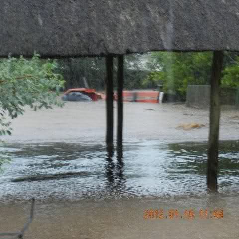
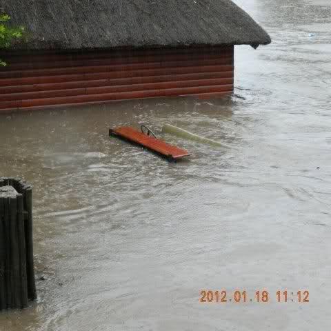
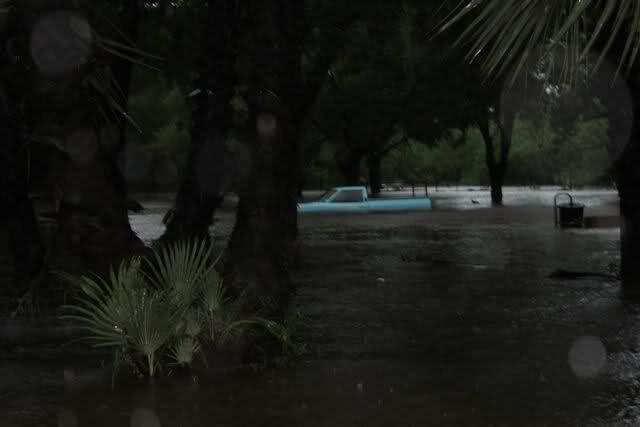
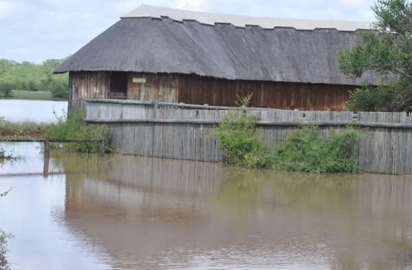
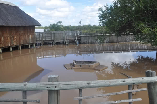
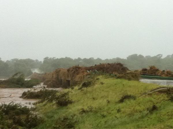
spaniel wrote:Herewith photo's of the rain on Wednesday morning 18th Jan 2012 at about 7h45 to 8h00. Think we got out at Phabeni just in time - we weren't aware of anything except that gravel roads south of Skukuza were closed due to the rain??


Image

Image

Image


User avatar
Flutterby
Posts: 44029
Joined: Sat May 19, 2012 12:28 pm
Country: South Africa
Location: Gauteng, South Africa
Contact:

Re: Pictures of the 2012 Floods

Post by Flutterby »

Joep Stevens wrote:Dear All,

Having been closely in contact with the Kruger team and having been involved in / effected by the 2000 floods of 7 and 24 February 2000, there are a couple of interesting characteristics of the two disasters:

1. 2000 floods generally far more severe especially the 7 February one which hit the southern portion very hard.
2. I would say that this 18 January 2012 flood was worse than the 24 February 2000 one which hit the north and central areas quite hard.
3. My take on bridge damage and reports is that 2012 flood resulted in higher levels (than possibly ever recorded before) in following rivers:
3.1 Nwaswitsontso (catchment in Manyeleti area west of Orpen) was incredibly high, completely engulfing Tshokwane and reaching higher levels in Talamati than in 2000.
3.2 Timbavati (catchment near Klaserie and theefore) severely affected by deluge that hit Hoedspruit and surroundings and also reached very high levels in the Park, flooding the tar road between Orpen and Satara and engulfing the entire Tamboti Camp (40 tents) which has been extensively damaged.
3.3 Olifants (due to Blyde, Timbavati, Selati and other swollen tributaries) also reached highest levels recorded (in my view in Park history, but stand to be corrected) for the first time ever flooding the high level bridge on the tar road between Satara and Letaba. Extensive damage to Balule.
3.4 Nwaswitshaka (catchment Pretoriuskop and south thereof) also reached higher levels than in 2000 and caused extensive damage to high level bridge on road between Kruger Gate and Skukuza.
3.5 There could be others that I am not aware of and certainly those that come to mind would be Nhlanganini (near Letaba), Sand (south), Biyamiti (south) and others.
4. Rivers that did not reach 2000 flood levels are, Sabie, Crocodile, Letaba and of course those that did not come down in flood in north such as Shingwedzi, Luvhuvhu and Limpopo.

Thanks to all for contributing!

Kind regards.

JOEP STEVENS


User avatar
Sprocky
Posts: 7110
Joined: Sat May 19, 2012 12:29 pm
Country: South Africa
Location: Grietjie Private Reserve
Contact:

Re: Pictures of the 2012 Floods

Post by Sprocky »

Photos of Sable Hide that were emailed to me...

Image

Image

Image


User avatar
Richprins
Committee Member
Posts: 75086
Joined: Sat May 19, 2012 3:52 pm
Location: NELSPRUIT
Contact:

Re: Pictures of the 2012 Floods

Post by Richprins »

These from Jabula Ntsiri Lodge Jan 18 (Timbavati River):


Image


It appears there is a vehicle floating past in the background.

Image


And a tractor:

Image


And spot the game-viewing vehicle!!


Image

(Pics courtesy of Fanta)


User avatar
Lisbeth
Site Admin
Posts: 65591
Joined: Sat May 19, 2012 12:31 pm
Country: Switzerland
Location: Lugano
Contact:

Latest update on the KNP flood notice

Post by Lisbeth »

All roads, except the following, are open:

S25 (From S26 to S139, Biyamiti Low Level Bridge inaccessible), S33, S84, Balule Low Level Bridge (detour via S89 and S90) (Balule Bridge is expected to reopen by 30 September 2012), H1-5 (From S91 to H8) (detour via S91, S92 & H8 – detour 17km of which 12km is gravel road) (Breach on H1-5 near N’wamanzi is expected to reopen by 30 September 2012).

Gates: All are open


"Education is the most powerful weapon which you can use to change the world." Nelson Mandela
The desire for equality must never exceed the demands of knowledge
User avatar
harrys
Posts: 12952
Joined: Fri Jun 01, 2012 5:37 am
Country: South Africa
Location: Warmbaths
Contact:

Re: Latest update on the KNP flood notice

Post by harrys »

Thanks Lis \O \O


KNP:
Locked

Return to “Kruger Information & General Discussion Forum”